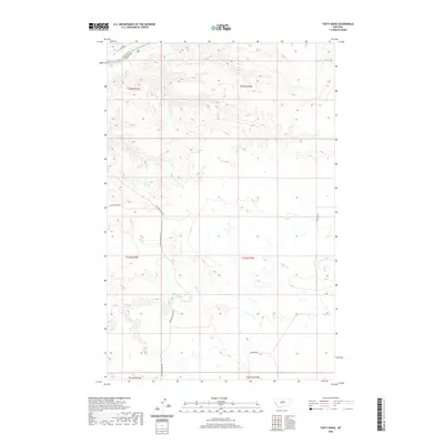
2020 Map of Taffy Ridge
USGS Topo · Published 2020About this map
The Missouri River forms the defining boundary in the northwestern corner of this territory, where the waters pass through the Dauphin Rapids. This point serves as the border between Blaine and Fergus Counties, marking a stark divide in the northern Montana landscape. From the river valley, the terrain transitions into a complex network of drainages and high ground, most notably along Wiskey Ridge Rd and the multiple branches of Taffy Cr.
Find a feature on this map
17 named features on this map. Tap any name to fly to it.
Don’t see what you’re looking for? This feature index may not catch every label — zoom into the map to look around manually.
Map Details
Editions of this 2020 Taffy Ridge Map
This is the sole edition of this map. No revisions or reprints were ever made.
Other maps of this area

1954 · Taffy Ridge
USGS Topo · 1:24,000

1954 · Bird Rapids
USGS Topo · 1:24,000

1954 · Leroy
USGS Topo · 1:24,000

1954 · Gallatin Rapids
USGS Topo · 1:24,000

1954 · Lewistown
USGS Topo · 1:250,000

1959 · Lewistown
USGS Topo · 1:250,000

1964 · Ragland Bench
USGS Topo · 1:24,000

1985 · Woodhawk Hill
USGS Topo · 1:24,000
1985 · Gerhard Corner
USGS Topo · 1:24,000
1985 · Winifred East
USGS Topo · 1:24,000