
1954 Map of Gallatin Rapids
USGS Topo · Published 1956About this map
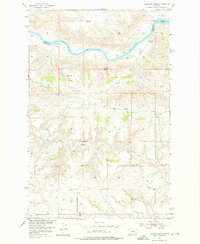
The Missouri River cuts through the border of Blaine and Fergus counties, a landscape defined by the treacherous Gallatin Rapids and Dauphin Rapids. Surveyed in the mid-1950s, this area reflects a remote portion of the Missouri River Basin where early petroleum exploration left its mark on the land. To the south of the river, Whiskey Ridge dominates the terrain, overlooking the winding path of Dog Creek. The map documents specific industrial activity at the base of Oil Well Hill, notably identifying the Oil Well (Alex) and Oil Well (Atwood) sites. These markers, alongside topographical landmarks like Jones Cone and Sugarloaf Rock, provide a precise record of the physical and commercial geography of the region before further modern development altered the Missouri's course and the surrounding high plains.
Find a feature on this map
15 named features on this map. Tap any name to fly to it.
Don’t see what you’re looking for? This feature index may not catch every label — zoom into the map to look around manually.
Map Details
Editions of this 1954 Gallatin Rapids Map
2 editions found
Other maps of this area

1954 · Taffy Ridge
USGS Topo · 1:24,000

1954 · Leroy
USGS Topo · 1:24,000

1954 · Council Island
USGS Topo · 1:24,000

1954 · Lewistown
USGS Topo · 1:250,000

1959 · Lewistown
USGS Topo · 1:250,000

1964 · Anderson Bridge
USGS Topo · 1:24,000

1964 · Ragland Bench
USGS Topo · 1:24,000

1964 · Chase Hill
USGS Topo · 1:24,000
1985 · Winifred East
USGS Topo · 1:24,000
1985 · Winifred West
USGS Topo · 1:24,000