
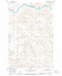
1954 Map of Council Island
USGS Topo · Published 1956About this map
The Missouri River cuts through this landscape at a tri-county junction, marking the borders between Chouteau, Fergus, and Blaine Counties. This 1954 field survey documents a river environment before modern alterations, highlighting navigability and crossing points such as Holmes Rapids and the Lohse PN Ferry near Council Island. The topography is defined by the sharp transition from the river valley to the high, dissected plateaus of Whiskey Ridge.
Find a feature on this map
16 named features on this map. Tap any name to fly to it.
Don’t see what you’re looking for? This feature index may not catch every label — zoom into the map to look around manually.
Map Details
Editions of this 1954 Council Island Map
2 editions found
Other maps of this area

1954 · P N Ranch
USGS Topo · 1:24,000

1954 · Gallatin Rapids
USGS Topo · 1:24,000

1954 · Lewistown
USGS Topo · 1:250,000

1959 · Lewistown
USGS Topo · 1:250,000

1964 · Wolf Creek Falls
USGS Topo · 1:24,000

1964 · Pigtail Coulee
USGS Topo · 1:24,000

1964 · Anderson Bridge
USGS Topo · 1:24,000

1964 · Ragland Bench
USGS Topo · 1:24,000

1964 · Chase Hill
USGS Topo · 1:24,000
1985 · Winifred West
USGS Topo · 1:24,000