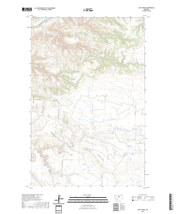
2024 Map of Taffy Ridge
USGS Topo · Published 2024About this map
The Missouri River cuts through the northern reaches of this landscape, its path protected within the Upper Missouri River Breaks National Monument. This terrain is characterized by a series of prominent high points and drainage systems, including the namesake Taffy Ridge and the nearby Whiskey Ridge. The area's geography is defined by the transition from these elevated ridges down to the watercourses of Taffy Creek and Cutbank Creek, which carve through the central and southern sections of the quadrangle. Transport through this isolated part of Montana relies on a sparse network of dirt and gravel routes. Local roads like Stafford Ferry Rd and Whiskey Ridge Rd provide access to the rugged interior, while Kjorlien Rd serves the southeastern territory, tracing the descent from Cutbank Ridge.
Find a feature on this map
16 named features on this map. Tap any name to fly to it.
Don’t see what you’re looking for? This feature index may not catch every label — zoom into the map to look around manually.
Map Details
Editions of this 2024 Taffy Ridge Map
This is the sole edition of this map. No revisions or reprints were ever made.
Other maps of this area

1954 · Taffy Ridge
USGS Topo · 1:24,000

1954 · Bird Rapids
USGS Topo · 1:24,000

1954 · Leroy
USGS Topo · 1:24,000

1954 · Gallatin Rapids
USGS Topo · 1:24,000

1954 · Lewistown
USGS Topo · 1:250,000

1959 · Lewistown
USGS Topo · 1:250,000

1964 · Ragland Bench
USGS Topo · 1:24,000

1985 · Woodhawk Hill
USGS Topo · 1:24,000
1985 · Gerhard Corner
USGS Topo · 1:24,000
1985 · Winifred East
USGS Topo · 1:24,000