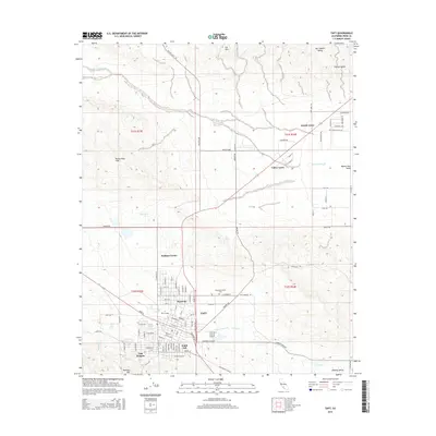
2015 Map of Taft
USGS Topo · Published 2015About this map
The Taft oil fields and the southwestern edge of the San Joaquin Valley define this landscape, where industrial infrastructure meets concentrated residential hubs. The city is surrounded by distinct communities including Ford City, Taft Heights, and South Taft, reflecting a dense pattern of settlement tied to the local energy economy. Taft College stands as a central institutional landmark within the urban grid, while the Westside District Cem and the Taft-Kern County Airport mark the transition toward the open terrain of the Midway Valley. To the north and west, the topographic relief of the Elk Hills and Buena Vista Hills rises sharply from the valley floor. These heights are crisscrossed by specialized routes like Gas Company Rd and Petroleum Club Rd, underscoring the area's long-standing connection to the petroleum industry. Drainage is defined by seasonal watercourses such as Buena Vista Creek and Sandy Cr, which navigate the arid gaps between the uplifted hills.
Find a feature on this map
105 named features on this map. Tap any name to fly to it.
Don’t see what you’re looking for? This feature index may not catch every label — zoom into the map to look around manually.
Map Details
Editions of this 2015 Taft Map
This is the sole edition of this map. No revisions or reprints were ever made.
Other maps of this area

1910 · Buena Vista Lake
USGS Topo · 1:125,000

1912 · McKittrick
USGS Topo · 1:125,000

1912 · Buena Vista Lake
USGS Topo · 1:125,000

1929 · Coles Levee
USGS Topo · 1:31,680

1929 · Mouth of Kern
USGS Topo · 1:31,680

1931 · Pentland Junction
USGS Topo · 1:31,680

1932 · West Elk Hills
USGS Topo · 1:31,680

1932 · East Elk Hills
USGS Topo · 1:31,680

1932 · Mouth of Kern
USGS Topo · 1:31,680
1933 · Tupman
USGS Topo · 1:31,680