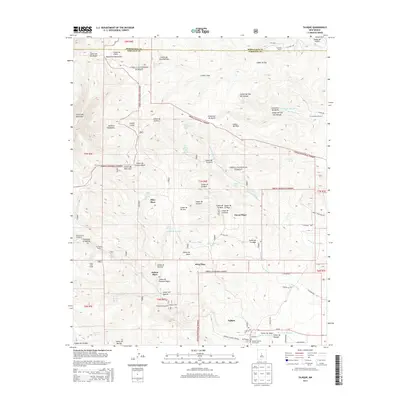
2013 Map of Tajique
USGS Topo · Published 2013About this map
The settlement of Tajique serves as the primary focal point of this 2013 survey of the eastern slopes of the Manzano Mountains. Located within the Cibola National Forest, this area is characterized by a network of family-named ranching and residential sites including Riley Place, King Place, and Nelson Place. These settlements are connected by a system of rural routes like Co Rd A019 and Anaya Loop. Cultural history is well-preserved at the southern end of the map, where the Old Tajique Cem and the Tajique Catholic Church Cem stand near the local Tajique PO.
Find a feature on this map
82 named features on this map. Tap any name to fly to it.
Don’t see what you’re looking for? This feature index may not catch every label — zoom into the map to look around manually.
Map Details
Editions of this 2013 Tajique Map
This is the sole edition of this map. No revisions or reprints were ever made.
Other maps of this area

1917 · Estancia
USGS Topo · 1:125,000

1954 · Bosque Peak
USGS Topo · 1:24,000

1954 · Chilili
USGS Topo · 1:24,000

1954 · Capilla Peak
USGS Topo · 1:24,000

1954 · Mount Washington
USGS Topo · 1:24,000

1954 · Torreon
USGS Topo · 1:24,000

1954 · Tajique
USGS Topo · 1:24,000

1954 · Escabosa
USGS Topo · 1:24,000

1954 · Milbourn Ranch
USGS Topo · 1:24,000

1954 · Torreon
USGS Topo · 1:62,500