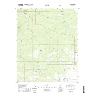
2020 Map of Tajique
USGS Topo · Published 2020About this map
Tajique lies at the foot of the Manzano Mountains and Manzanita Mountains in this modern topographical survey. The settlement is anchored by local heritage sites including the Old Tajique Cem and the Tajique Catholic Church Cem, situated near the banks of the Arroyo de Tajique. Much of the western and central terrain is defined by the protected lands of the Cibola National Forest, a landscape carved by numerous canyons such as Cañon de la Perra and Cañon de la Mula.
Find a feature on this map
69 named features on this map. Tap any name to fly to it.
Don’t see what you’re looking for? This feature index may not catch every label — zoom into the map to look around manually.
Map Details
Editions of this 2020 Tajique Map
This is the sole edition of this map. No revisions or reprints were ever made.
Other maps of this area

1917 · Estancia
USGS Topo · 1:125,000

1954 · Bosque Peak
USGS Topo · 1:24,000

1954 · Chilili
USGS Topo · 1:24,000

1954 · Capilla Peak
USGS Topo · 1:24,000

1954 · Mount Washington
USGS Topo · 1:24,000

1954 · Torreon
USGS Topo · 1:24,000

1954 · Tajique
USGS Topo · 1:24,000

1954 · Escabosa
USGS Topo · 1:24,000

1954 · Milbourn Ranch
USGS Topo · 1:24,000

1954 · Torreon
USGS Topo · 1:62,500