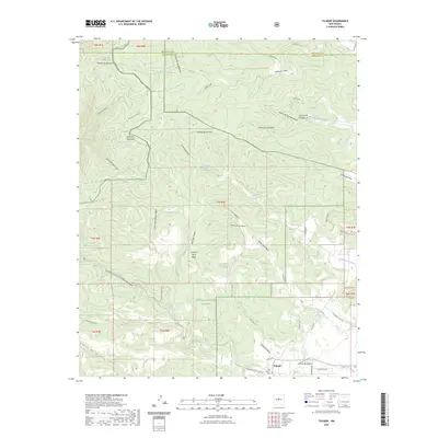
2023 Map of Tajique
USGS Topo · Published 2023About this map
Tajique lies along the eastern slopes of the Manzano Mountains and Manzanita Mountains, serving as a central hub for the small network of roads that thread through the eastern edge of the Cibola National Forest. The landscape is defined by a series of dramatic canyons and springs, including Cañon de Chillili and Cañon de la Perra, which drain toward the valley floor. Genealogists and local historians will find the Old Tajique Cem noted just south of the main settlement near Arroyo de Tajique. This 2023 survey illustrates the intersection of modern road names like Anaya Loop and Sherwood Rd with traditional water-source landmarks such as Ojo La Casa and Tejano Spring. The topography transitions from the high peaks in the west toward Capitol Hill and the plains of Torrance County in the east, following established canyon lines.
Find a feature on this map
70 named features on this map. Tap any name to fly to it.
Don’t see what you’re looking for? This feature index may not catch every label — zoom into the map to look around manually.
Map Details
Editions of this 2023 Tajique Map
This is the sole edition of this map. No revisions or reprints were ever made.
Other maps of this area

1917 · Estancia
USGS Topo · 1:125,000

1954 · Bosque Peak
USGS Topo · 1:24,000

1954 · Chilili
USGS Topo · 1:24,000

1954 · Capilla Peak
USGS Topo · 1:24,000

1954 · Mount Washington
USGS Topo · 1:24,000

1954 · Torreon
USGS Topo · 1:24,000

1954 · Tajique
USGS Topo · 1:24,000

1954 · Escabosa
USGS Topo · 1:24,000

1954 · Milbourn Ranch
USGS Topo · 1:24,000

1954 · Torreon
USGS Topo · 1:62,500