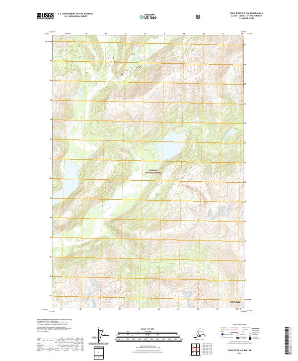
2021 Map of Taku River A-5 NW
USGS Topo · Published 2021About this map
Tongass National Forest dominates this landscape southeast of the Juneau city and borough limits. The terrain is defined by the winding course of the Speel River, which flows through the heart of the quadrangle, joined by the Long River as it moves through the coastal mountains. To the west, Indian Lake sits tucked into the high elevations, while numerous unnamed wetlands and steep contour lines illustrate the complex drainage patterns characteristic of the Alaska Panhandle. This 2021 study shows the area's public land survey system grid, including townships t42s r72e and t43s r73e, providing a clear record of the administrative boundaries that define this protected wilderness area.
Find a feature on this map
9 named features on this map. Tap any name to fly to it.
Don’t see what you’re looking for? This feature index may not catch every label — zoom into the map to look around manually.
Map Details
Editions of this 2021 Taku River A-5 NW Map
This is the sole edition of this map. No revisions or reprints were ever made.
Other maps of this area

1951 · Taku River B-6
USGS Topo · 1:63,360

1951 · Taku River A-5
USGS Topo · 1:63,360

1951 · Taku River A-6
USGS Topo · 1:63,360

1951 · Taku River B-5
USGS Topo · 1:63,360

1953 · Taku River
USGS Topo · 1:250,000

1960 · Taku River
USGS Topo · 1:250,000

1994 · Taku River B-6
USGS Topo · 1:63,360
1996 · Taku River A-5
USGS Topo · 1:63,360
2017 · Taku River B-5 SW
USGS Topo · 1:25,000
2017 · Taku River B-6 SE
USGS Topo · 1:25,000