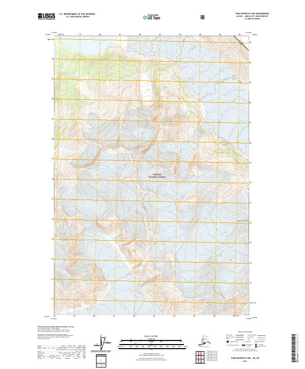
2021 Map of Taku River B-5 NW
USGS Topo · Published 2021About this map
Tongass National Forest dominates this landscape along the international border, where the ice and rock of the Coast Mountains define the terrain. The glacial environment is documented through the massive Wright Glacier and Bridge Glacier, which shape the drainage patterns of the high country. Water flows from these frozen heights into the Wright River and Hidden Cr, marking a wilderness essentially untouched by modern infrastructure. The map also delineates the precise boundary between the United States and Canada, showing the jagged line where Alaska meets British Columbia. This survey serves as a vital record of the shifting glacial margins and high-elevation hydrology in a region defined by its extreme elevation changes and ice-carved valleys.
Find a feature on this map
11 named features on this map. Tap any name to fly to it.
Don’t see what you’re looking for? This feature index may not catch every label — zoom into the map to look around manually.
Map Details
Editions of this 2021 Taku River B-5 NW Map
This is the sole edition of this map. No revisions or reprints were ever made.
Other maps of this area

1951 · Taku River B-6
USGS Topo · 1:63,360

1951 · Taku River B-5
USGS Topo · 1:63,360

1953 · Taku River
USGS Topo · 1:250,000
1960 · Taku River C-5
USGS Topo · 1:63,360

1960 · Taku River C-6
USGS Topo · 1:63,360

1960 · Taku River
USGS Topo · 1:250,000

1994 · Taku River B-6
USGS Topo · 1:63,360

1995 · Taku River C-6
USGS Topo · 1:63,360
2017 · Taku River B-5 SW
USGS Topo · 1:25,000
2017 · Taku River B-6 SE
USGS Topo · 1:25,000