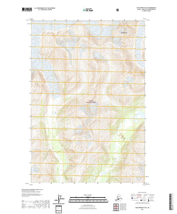
2021 Map of Taku River B-5 SW
USGS Topo · Published 2021About this map
Glacial ice and high-elevation terrain dominate this 2021 study of the Juneau borough and city limits. Most of the landscape is contained within the Tongass National Forest, characterized by vast ice fields that feed into the valley of the Speel River at the southern edge of the quadrangle. The map reveals the intricate drainage patterns where glacial melt meets the river system, providing a precise look at the hydrology of the Alaska Panhandle before it reaches the coastal inlets. While no roads or buildings appear in this remote section, the intricate contour lines and township markers like t40s r71e and t41s r73e provide a detailed grid for navigating this wilderness area.
Find a feature on this map
9 named features on this map. Tap any name to fly to it.
Don’t see what you’re looking for? This feature index may not catch every label — zoom into the map to look around manually.
Map Details
Editions of this 2021 Taku River B-5 SW Map
This is the sole edition of this map. No revisions or reprints were ever made.
Other maps of this area

1951 · Taku River B-6
USGS Topo · 1:63,360

1951 · Taku River A-5
USGS Topo · 1:63,360

1951 · Taku River A-6
USGS Topo · 1:63,360

1951 · Taku River B-5
USGS Topo · 1:63,360

1953 · Taku River
USGS Topo · 1:250,000

1960 · Taku River
USGS Topo · 1:250,000

1994 · Taku River B-6
USGS Topo · 1:63,360
1996 · Taku River A-5
USGS Topo · 1:63,360
2017 · Taku River B-5 SW
USGS Topo · 1:25,000
2017 · Taku River B-6 SE
USGS Topo · 1:25,000