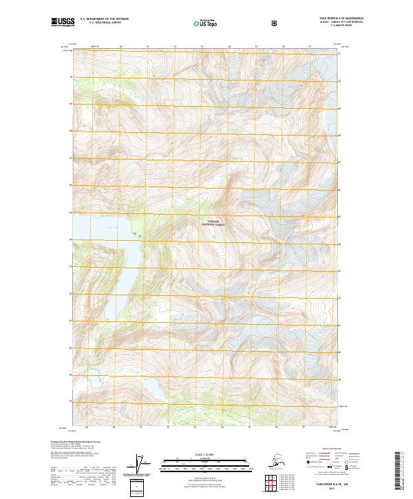
2021 Map of Taku River B-6 SE
USGS Topo · Published 2021About this map
Tongass National Forest dominates this Alaskan landscape, where the drainage systems of Davidson Cr and Turner Cr carve through the high-elevation terrain. This 2021 survey focuses on a remote section of the Juneau City and Borough, centered on the significant waters of Turner Lake. The map illustrates the complex hydrography of the region, showing how these glacial and snow-fed streams feed into the larger lake system amidst the protected forest lands. While the area lacks developed settlements or roads, the precise contour mapping and township boundaries, such as t41s r71e, provide essential data for understanding the physical geography and natural boundaries within this part of Southeast Alaska.
Find a feature on this map
10 named features on this map. Tap any name to fly to it.
Don’t see what you’re looking for? This feature index may not catch every label — zoom into the map to look around manually.
Map Details
Editions of this 2021 Taku River B-6 SE Map
This is the sole edition of this map. No revisions or reprints were ever made.
Other maps of this area

1951 · Taku River B-6
USGS Topo · 1:63,360

1951 · Taku River A-5
USGS Topo · 1:63,360

1951 · Taku River A-6
USGS Topo · 1:63,360

1951 · Taku River B-5
USGS Topo · 1:63,360

1953 · Taku River
USGS Topo · 1:250,000

1960 · Taku River
USGS Topo · 1:250,000

1994 · Taku River B-6
USGS Topo · 1:63,360
1996 · Taku River A-5
USGS Topo · 1:63,360
2017 · Taku River B-5 SW
USGS Topo · 1:25,000
2017 · Taku River B-6 SE
USGS Topo · 1:25,000