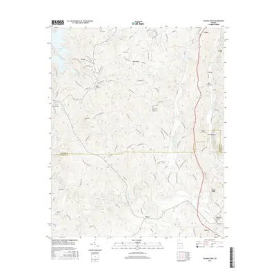
2017 Map of Talking Rock
USGS Topo · Published 2017About this map
Talking Rock Creek meanders through this portion of northern Georgia, defining the rural character of the borderlands between Gilmer and Pickens counties. The landscape is dotted with small, long-standing communities such as Whitestone, Blaine, and Talona, each centered around local transit routes and water sources. Genealogists will find significant value in the numerous documented burial grounds, including the Berean Baptist Church Cem and the Mountain Cem, which serve as anchors for family history in the region. The map captures a moment of modern connectivity where old secondary roads like Tavern on the Hill Rd and Old Whitestone Rd intersect with the more developed corridors near Jasper and Ellijay. Industrial and agricultural remnants are also evident, notably at Carns Mill, illustrating the historical reliance on the area's waterways for local commerce.
Find a feature on this map
111 named features on this map. Tap any name to fly to it.
Don’t see what you’re looking for? This feature index may not catch every label — zoom into the map to look around manually.
Map Details
Editions of this 2017 Talking Rock Map
This is the sole edition of this map. No revisions or reprints were ever made.
Other maps of this area

1886 · Dalton
USGS Topo · 1:125,000

1888 · Ellijay
USGS Topo · 1:125,000

1890 · Suwanee
USGS Topo · 1:125,000

1890 · Cartersville
USGS Topo · 1:125,000

1891 · Cartersville
USGS Topo · 1:125,000

1892 · Ellijay
USGS Topo · 1:125,000

1892 · Dalton
USGS Topo · 1:125,000

1894 · Suwanee
USGS Topo · 1:125,000

1896 · Cartersville
USGS Topo · 1:125,000

1897 · Dalton
USGS Topo · 1:125,000