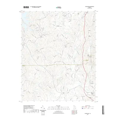
2020 Map of Talking Rock
USGS Topo · Published 2020About this map
Talking Rock Creek carves a deep path through this North Georgia landscape, winding past the settlements of Talking Rock and Blaine. The map documents a corridor of community history defined by its rural churches and burial grounds, including the Mount Pisgah Baptist Church Cem and the Berean Baptist Church Cem. Near the northern edge, Carters Lake reaches into the terrain, while the eastern side is marked by the industrial and residential clusters at Whitestone and the family-named landmark at Carns Mill. The area's topography is anchored by prominent heights like Doll Mtn and Log Round Mtn, which overlook a network of creeks such as Scarecorn Cr and Talona Cr. This survey provides a modern view of Gilmer and Pickens counties, showing how contemporary infrastructure like the Gilmer County Airport integrates with long-standing local landmarks.
Find a feature on this map
131 named features on this map. Tap any name to fly to it.
Don’t see what you’re looking for? This feature index may not catch every label — zoom into the map to look around manually.
Map Details
Editions of this 2020 Talking Rock Map
This is the sole edition of this map. No revisions or reprints were ever made.
Other maps of this area

1886 · Dalton
USGS Topo · 1:125,000

1888 · Ellijay
USGS Topo · 1:125,000

1890 · Suwanee
USGS Topo · 1:125,000

1890 · Cartersville
USGS Topo · 1:125,000

1891 · Cartersville
USGS Topo · 1:125,000

1892 · Ellijay
USGS Topo · 1:125,000

1892 · Dalton
USGS Topo · 1:125,000

1894 · Suwanee
USGS Topo · 1:125,000

1896 · Cartersville
USGS Topo · 1:125,000

1897 · Dalton
USGS Topo · 1:125,000