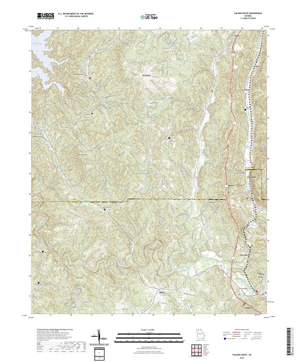
2024 Map of Talking Rock
USGS Topo · Published 2024About this map
Talking Rock and the surrounding rural communities of Whitestone and Blaine are documented in this recent survey of the North Georgia landscape. The map highlights a series of valleys and ridges, where the Gilmer Co and Pickens Co line cuts through a network of creeks including Talking Rock Creek, Talona Creek, and Ball Creek. Family and community history is preserved through the locations of numerous burial grounds, such as Whitestone Baptist Church Cem, Mount Pisgah Cem, and the Holmes Cem.
Find a feature on this map
124 named features on this map. Tap any name to fly to it.
Don’t see what you’re looking for? This feature index may not catch every label — zoom into the map to look around manually.
Map Details
Editions of this 2024 Talking Rock Map
This is the sole edition of this map. No revisions or reprints were ever made.
Other maps of this area

1886 · Dalton
USGS Topo · 1:125,000

1888 · Ellijay
USGS Topo · 1:125,000

1890 · Suwanee
USGS Topo · 1:125,000

1890 · Cartersville
USGS Topo · 1:125,000

1891 · Cartersville
USGS Topo · 1:125,000

1892 · Ellijay
USGS Topo · 1:125,000

1892 · Dalton
USGS Topo · 1:125,000

1894 · Suwanee
USGS Topo · 1:125,000

1896 · Cartersville
USGS Topo · 1:125,000

1897 · Dalton
USGS Topo · 1:125,000