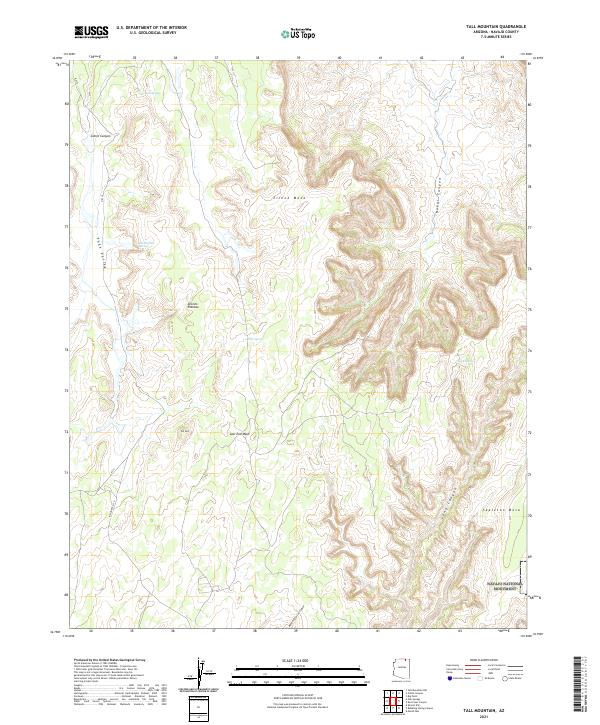
2021 Map of Tall Mountain
USGS Topo · Published 2021About this map
Navajo National Monument occupies the southeastern corner of this high-elevation landscape in Navajo County, where massive landforms like Skeleton Mesa and Zilnez Mesa define the horizon. The terrain is a complex network of drainage systems, including Nokai Canyon, Long Canyon, and the deeply incised Bubbling Spring Canyon. These features illustrate the erosion patterns across the Shonto Plateau, a region where water sources are vital but sparse. Scattered throughout the canyons and valleys are essential water points such as Oat Spring, Hawks Nest Spring, and Deer Spring. Evidence of human movement and infrastructure is centered on the corridor of Indian Rte 6310, which navigates the variable elevations between landmarks like Tall Mtn and the broad expanse of Sage Valley. The map detail provides a clear view of the relationship between the plateau's natural springs and the primary travel routes through the desert floor.
Find a feature on this map
21 named features on this map. Tap any name to fly to it.
Don’t see what you’re looking for? This feature index may not catch every label — zoom into the map to look around manually.
Map Details
Editions of this 2021 Tall Mountain Map
This is the sole edition of this map. No revisions or reprints were ever made.
Other maps of this area

1883 · Marsh Pass
USGS Topo · 1:250,000

1892 · Marsh Pass
USGS Topo · 1:250,000

1952 · Shato Spring 1 NE
USGS Topo · 1:24,000

1952 · Agathla Peak 2 SW
USGS Topo · 1:24,000

1952 · Agathla Peak 2 NW
USGS Topo · 1:24,000

1952 · Boot Mesa
USGS Topo · 1:62,500

1956 · Marble Canyon
USGS Topo · 1:250,000

1959 · Marble Canyon
USGS Topo · 1:250,000

1961 · Marble Canyon
USGS Topo · 1:250,000

1968 · Marsh Pass
USGS Topo · 1:24,000