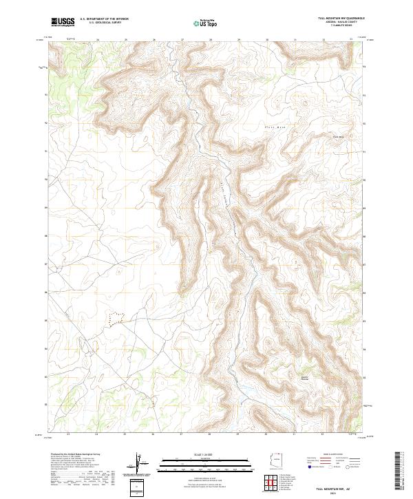
2021 Map of Tall Mountain NW
USGS Topo · Published 2021About this map
Piute Canyon dominates the central topography of this Navajo County landscape, carving a deep north-south path toward the northern boundary. The high ground is defined by the broad Piute Mesa to the northeast and the rising elevations of the Shonto Plateau in the southeast. This modern survey illustrates a territory primarily structured by natural drainage and high-desert relief, with the ephemeral waters of Piute Creek winding through the canyon floor. Transportation in this high-altitude region is sparse, anchored by the passage of N Rte 16 in the southwest. The map provides a clear look at the Public Land Survey System grid across T41N and T40N, showing how these administrative lines overlay the complex drainage systems of the Piute Cr watershed.
Find a feature on this map
10 named features on this map. Tap any name to fly to it.
Don’t see what you’re looking for? This feature index may not catch every label — zoom into the map to look around manually.
Map Details
Editions of this 2021 Tall Mountain NW Map
This is the sole edition of this map. No revisions or reprints were ever made.
Other maps of this area

1883 · Marsh Pass
USGS Topo · 1:250,000

1886 · Henry Mountains
USGS Topo · 1:250,000

1892 · Marsh Pass
USGS Topo · 1:250,000

1892 · Henry Mountains
USGS Topo · 1:250,000

1952 · Shato Spring 1 NE
USGS Topo · 1:24,000

1952 · Navajo Mtn. 4 SE
USGS Topo · 1:24,000

1953 · Navajo Mountain 4 SW
USGS Topo · 1:24,000

1953 · Navajo Mountain
USGS Topo · 1:62,500

1953 · No Mans Mesa
USGS Topo · 1:62,500

1956 · Escalante
USGS Topo · 1:250,000