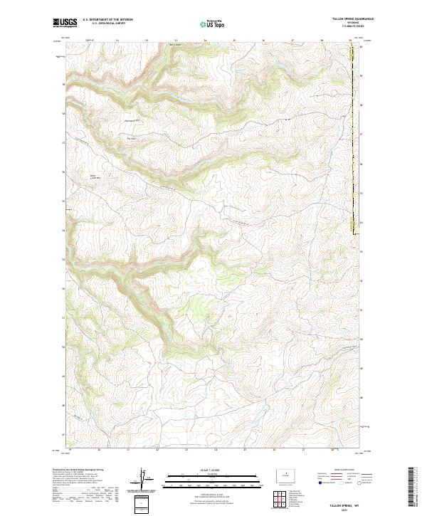
2021 Map of Tallon Spring
USGS Topo · Published 2021About this map
Tallon Spring is a focal point of this high-altitude drainage basin along the border of Washakie and Johnson Counties. The landscape is defined by the headwaters of the Otter Creek system, including the N Fork Otter Cr, Middle Fork Otter Cr, and S Fork Otter Cr. Distinctive landforms such as Eberhardt Vee, The Vees, and Box Canyon indicate a deeply incised topography where seasonal water sources like Deadmans Spring were essential for survival. Modern access to this remote corner of Wyoming is provided by Otter Creek Vee Rd and Dry Farm Rd, tracing routes through an area largely shaped by natural contours rather than dense human settlement. This map reveals the intricate network of canyons and forks that feed into the larger Bighorn Basin watershed.
Find a feature on this map
19 named features on this map. Tap any name to fly to it.
Don’t see what you’re looking for? This feature index may not catch every label — zoom into the map to look around manually.
Map Details
Editions of this 2021 Tallon Spring Map
This is the sole edition of this map. No revisions or reprints were ever made.
Other maps of this area

1955 · Arminto
USGS Topo · 1:250,000

1958 · Arminto
USGS Topo · 1:250,000

1962 · Arminto
USGS Topo · 1:250,000

1966 · Monument Hill
USGS Topo · 1:24,000

1966 · Big Trails
USGS Topo · 1:24,000

1966 · Big Trails NE
USGS Topo · 1:24,000
1966 · Tallon Spring
USGS Topo · 1:24,000

1967 · Mahogany Butte
USGS Topo · 1:24,000
1967 · Beartrap Meadows
USGS Topo · 1:24,000
1967 · Tabletop
USGS Topo · 1:24,000