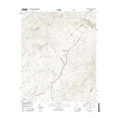
2014 Map of Tallulah Falls
USGS Topo · Published 2014About this map
Tallulah Gorge dominates the northeastern corner of this terrain, where the boundary between Rabun and Habersham counties follows the dramatic drops of the Tallulah River. This 2014 survey documents the landscape around Hollywood and Turnerville as modern residential developments like Holly Hill Ests and The Orchard Rd interface with the protected boundaries of the Chattahoochee National Forest. Genealogists and local researchers will find several well-established burial sites mapped, including Shirley Grove Cem and Mt Zion Cem. The map illustrates the transport corridor of US Hwy 23 and Historic Old Highway 441, showing the evolution of mountain travel routes from traditional roadbeds to modern expressways near landmarks such as Hickory Nut Mtn and Lake Rabun.
Find a feature on this map
124 named features on this map. Tap any name to fly to it.
Don’t see what you’re looking for? This feature index may not catch every label — zoom into the map to look around manually.
Map Details
Editions of this 2014 Tallulah Falls Map
This is the sole edition of this map. No revisions or reprints were ever made.
Other maps of this area

1886 · Dahlonega
USGS Topo · 1:125,000

1886 · Walhalla
USGS Topo · 1:125,000

1892 · Dahlonega
USGS Topo · 1:125,000

1892 · Walhalla
USGS Topo · 1:125,000

1896 · Walhalla
USGS Topo · 1:125,000

1896 · Dahlonega
USGS Topo · 1:125,000

1903 · Dahlonega
USGS Topo · 1:125,000

1953 · Tallulah Falls
USGS Topo · 1:24,000

1954 · Greenville
USGS Topo · 1:250,000
1957 · Lake Burton
USGS Topo · 1:24,000