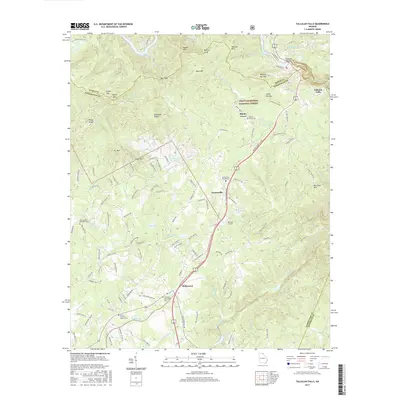
2017 Map of Tallulah Falls
USGS Topo · Published 2017About this map
Tallulah Gorge and the Tallulah River dominate the northeastern corner of this landscape, marking a dramatic geological transition at the Rabun and Habersham County line. The era's transportation infrastructure is defined by the corridor of US Hwy 23, which bypasses several smaller communities while tracing the historical influence of the Tallulah Falls Ry. Settlements like Turnerville and Hollywood are established along this central spine, while the surrounding terrain is punctuated by significant water bodies, including Lake Rabun and Tallulah Falls Lake.
Find a feature on this map
138 named features on this map. Tap any name to fly to it.
Don’t see what you’re looking for? This feature index may not catch every label — zoom into the map to look around manually.
Map Details
Editions of this 2017 Tallulah Falls Map
This is the sole edition of this map. No revisions or reprints were ever made.
Other maps of this area

1886 · Dahlonega
USGS Topo · 1:125,000

1886 · Walhalla
USGS Topo · 1:125,000

1892 · Dahlonega
USGS Topo · 1:125,000

1892 · Walhalla
USGS Topo · 1:125,000

1896 · Walhalla
USGS Topo · 1:125,000

1896 · Dahlonega
USGS Topo · 1:125,000

1903 · Dahlonega
USGS Topo · 1:125,000

1953 · Tallulah Falls
USGS Topo · 1:24,000

1954 · Greenville
USGS Topo · 1:250,000
1957 · Lake Burton
USGS Topo · 1:24,000