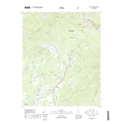
2020 Map of Tallulah Falls
USGS Topo · Published 2020About this map
Tallulah Gorge and the Tallulah River dominate the northeastern corner of this landscape, carving through the mountainous terrain of the Chattahoochee National Forest. The geography is defined by a series of prominent peaks and ridges, including Apple Pie Mtn, Hickory Nut Mtn, and Rocky Mtn, which separate numerous creek drainages like Panther Creek and Deep Creek.
Find a feature on this map
145 named features on this map. Tap any name to fly to it.
Don’t see what you’re looking for? This feature index may not catch every label — zoom into the map to look around manually.
Map Details
Editions of this 2020 Tallulah Falls Map
This is the sole edition of this map. No revisions or reprints were ever made.
Other maps of this area

1886 · Dahlonega
USGS Topo · 1:125,000

1886 · Walhalla
USGS Topo · 1:125,000

1892 · Dahlonega
USGS Topo · 1:125,000

1892 · Walhalla
USGS Topo · 1:125,000

1896 · Walhalla
USGS Topo · 1:125,000

1896 · Dahlonega
USGS Topo · 1:125,000

1903 · Dahlonega
USGS Topo · 1:125,000

1953 · Tallulah Falls
USGS Topo · 1:24,000

1954 · Greenville
USGS Topo · 1:250,000
1957 · Lake Burton
USGS Topo · 1:24,000