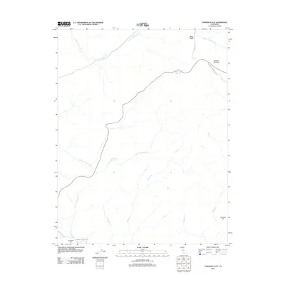
2012 Map of Tamarack Flat
USGS Topo · Published 2012About this map
White Wolf and Tamarack Flat serve as primary points of human activity in this high-elevation landscape within Tuolumne County. The area is defined by the drainage basins of the Middle Tuolumne River and the S Fork Tuolumne River, which are fed by numerous seasonal tributaries such as Cascade Cr, Ribbon Cr, and Coyote Cr. Transportation through this wilderness is anchored by the Yosemite National Park Rd and the historic route of the Old Big Oak Flat Rd, reflecting the long-standing infrastructure developed for mountain transit.
Find a feature on this map
16 named features on this map. Tap any name to fly to it.
Don’t see what you’re looking for? This feature index may not catch every label — zoom into the map to look around manually.
Map Details
Editions of this 2012 Tamarack Flat Map
This is the sole edition of this map. No revisions or reprints were ever made.
Other maps of this area

1897 · Yosemite
USGS Topo · 1:125,000

1900 · Yosemite
USGS Topo · 1:125,000

1903 · Yosemite
USGS Topo · 1:125,000

1909 · Yosemite
USGS Topo · 1:125,000

1947 · El Portal
USGS Topo · 1:24,000

1947 · Mariposa
USGS Topo · 1:250,000

1947 · El Portal
USGS Topo · 1:62,500

1948 · Mariposa
USGS Topo · 1:250,000
1949 · El Portal
USGS Topo · 1:24,000

1956 · Hetch Hetchy Reservoir
USGS Topo · 1:62,500