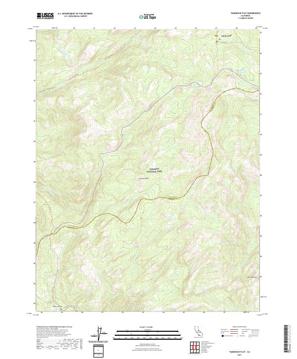
2021 Map of Tamarack Flat
USGS Topo · Published 2021About this map
Yosemite National Park encompasses the high-altitude terrain shown in this 2021 study, where the Sierra Nevada landscape is defined by the headwaters of the Middle Tuolumne River and the S Fork Tuolumne River. The map details the transition between administrative boundaries at the Tuolumne Co Mariposa Co line, illustrating how historic transport routes like the Old Tioga Road Trl and Old Big Oak Flat Road Trl negotiate the complex topography. At the northern edge, White Wolf and McSwain Meadows represent key clearings and stopping points amidst the dense forest and granite heights. To the south, the settlement at Tamarack Flat serves as a focal point for tracing the drainage patterns of Tamarack Cr and Coyote Cr. This cartography provides a modern look at legacy trails and water features like Siesta Lake before they reach the higher peaks of the range.
Find a feature on this map
24 named features on this map. Tap any name to fly to it.
Don’t see what you’re looking for? This feature index may not catch every label — zoom into the map to look around manually.
Map Details
Editions of this 2021 Tamarack Flat Map
This is the sole edition of this map. No revisions or reprints were ever made.
Other maps of this area

1897 · Yosemite
USGS Topo · 1:125,000

1900 · Yosemite
USGS Topo · 1:125,000

1903 · Yosemite
USGS Topo · 1:125,000

1909 · Yosemite
USGS Topo · 1:125,000

1947 · El Portal
USGS Topo · 1:24,000

1947 · Mariposa
USGS Topo · 1:250,000

1947 · El Portal
USGS Topo · 1:62,500

1948 · Mariposa
USGS Topo · 1:250,000
1949 · El Portal
USGS Topo · 1:24,000

1956 · Hetch Hetchy Reservoir
USGS Topo · 1:62,500