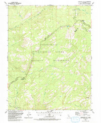
1990 Map of Tamarack Flat
USGS Topo · Published 1990About this map
Yosemite National Park and the expansive Yosemite Wilderness dominate this high-country landscape, where the Middle Tuolumne River and the South Fork Tuolumne River carve through the granite terrain. The survey identifies the settlement at White Wolf and the winding route of Tioga Road, which serves as the primary artery through this alpine environment. High-elevation features like Siesta Lake and the grazing grounds of McSwain Meadows are shown alongside steep drainages such as Cascade Creek and Ribbon Creek. The map also delineates the high point at Boundary Hill and the county line between Tuolumne Co and Mariposa Co, offering a detailed view of the park's interior before modern digital mapping. This 1990 edition reflects the management of these protected lands just prior to the turn of the millennium.
Find a feature on this map
19 named features on this map. Tap any name to fly to it.
Don’t see what you’re looking for? This feature index may not catch every label — zoom into the map to look around manually.
Map Details
Editions of this 1990 Tamarack Flat Map
This is the sole edition of this map. No revisions or reprints were ever made.
Other maps of this area

1897 · Yosemite
USGS Topo · 1:125,000

1900 · Yosemite
USGS Topo · 1:125,000

1903 · Yosemite
USGS Topo · 1:125,000

1909 · Yosemite
USGS Topo · 1:125,000

1947 · El Portal
USGS Topo · 1:24,000

1947 · Mariposa
USGS Topo · 1:250,000

1947 · El Portal
USGS Topo · 1:62,500

1948 · Mariposa
USGS Topo · 1:250,000
1949 · El Portal
USGS Topo · 1:24,000

1956 · Hetch Hetchy Reservoir
USGS Topo · 1:62,500