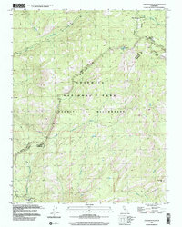
1997 Map of Tamarack Flat
USGS Topo · Published 2002About this map
Yosemite National Park and the Yosemite Wilderness dominate this high-country landscape, where the geography of the Sierra Nevada is traced through its drainage systems and recreation hubs. The map follows the critical corridor of Tioga Road, which provides access to seasonal settlements like the White Wolf Campground and Tamarack Flat Campground. These locales, along with McSwain Meadows, reflect the late 20th-century management of the park's interior. The terrain is defined by the steep descents of the Middle Tuolumne River and the South Fork Tuolumne River, fed by high-elevation water bodies such as Siesta Lake and several prominent drainages including Cascade Creek and Ribbon Creek. The Tuolumne Co Mariposa Co line cuts across the southern portion of the sheet near Boundary Hill, marking the administrative divide in this protected wilderness area.
Find a feature on this map
16 named features on this map. Tap any name to fly to it.
Don’t see what you’re looking for? This feature index may not catch every label — zoom into the map to look around manually.
Map Details
Editions of this 1997 Tamarack Flat Map
This is the sole edition of this map. No revisions or reprints were ever made.
Other maps of this area

1897 · Yosemite
USGS Topo · 1:125,000

1900 · Yosemite
USGS Topo · 1:125,000

1903 · Yosemite
USGS Topo · 1:125,000

1909 · Yosemite
USGS Topo · 1:125,000

1947 · El Portal
USGS Topo · 1:24,000

1947 · Mariposa
USGS Topo · 1:250,000

1947 · El Portal
USGS Topo · 1:62,500

1948 · Mariposa
USGS Topo · 1:250,000
1949 · El Portal
USGS Topo · 1:24,000

1956 · Hetch Hetchy Reservoir
USGS Topo · 1:62,500