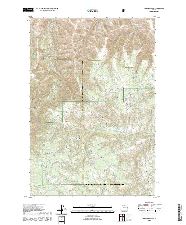
2023 Map of Tamarack Gulch
USGS Topo · Published 2023About this map
The borderlands of Whitman National Forest and Umatilla National Forest converge in this high-elevation landscape, where the administrative boundaries of Umatilla and Union counties shift across the terrain. This is a region defined by complex drainage networks, where Meadow Creek and McCoy Creek carve through the timbered uplands. The presence of numerous named springs, such as Tamarack Spring, Jungle Spring, and McClellan Spring, indicates a geography where water sources were critical for forest management and local ecology.
Find a feature on this map
26 named features on this map. Tap any name to fly to it.
Don’t see what you’re looking for? This feature index may not catch every label — zoom into the map to look around manually.
Map Details
Editions of this 2023 Tamarack Gulch Map
This is the sole edition of this map. No revisions or reprints were ever made.
Other maps of this area

1953 · Pendleton
USGS Topo · 1:250,000

1956 · Pendleton
USGS Topo · 1:250,000
1967 · Bassey Creek
USGS Topo · 1:24,000

1967 · Sullivan Gulch
USGS Topo · 1:24,000

1967 · Lehman Springs
USGS Topo · 1:24,000

1967 · Granite Meadows
USGS Topo · 1:24,000

1967 · Bally Mountain
USGS Topo · 1:24,000

1967 · Pilot Rock
USGS Topo · 1:24,000

1967 · Owens Butte
USGS Topo · 1:24,000
1967 · Sevenmile Creek
USGS Topo · 1:24,000