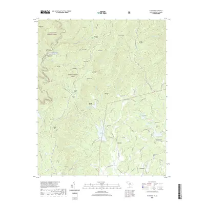
2020 Map of Tamassee
USGS Topo · Published 2020About this map
Cheohee and Tamassee anchor the southeastern portion of this map, situated where the rolling hills of the Sumter National Forest begin to rise into the Blue Ridge. The landscape is defined by the sharp descent of the Chattooga Wild and Scenic River, which forms the boundary between South Carolina and Georgia. A high density of family cemeteries, including Winchester Cem, Wolf Pit Cem, and the Whitmire Methodist Church Graveyard, suggests deep ancestral roots in these mountain coves.
Find a feature on this map
105 named features on this map. Tap any name to fly to it.
Don’t see what you’re looking for? This feature index may not catch every label — zoom into the map to look around manually.
Map Details
Editions of this 2020 Tamassee Map
This is the sole edition of this map. No revisions or reprints were ever made.
Other maps of this area

1886 · Walhalla
USGS Topo · 1:125,000

1888 · Pickens
USGS Topo · 1:125,000

1891 · Cowee
USGS Topo · 1:125,000

1892 · Walhalla
USGS Topo · 1:125,000

1894 · Pickens
USGS Topo · 1:125,000

1896 · Walhalla
USGS Topo · 1:125,000

1897 · Cowee
USGS Topo · 1:125,000

1905 · Pisgah
USGS Topo · 1:125,000

1906 · Pisgah
USGS Topo · 1:125,000

1907 · Cowee
USGS Topo · 1:125,000