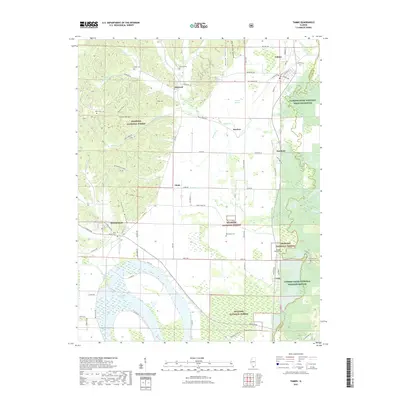
2021 Map of Tamms
USGS Topo · Published 2021About this map
Horseshoe Lake and the wetlands of the Cypress Creek National Wildlife Refuge dominate this southern Illinois landscape, where the Cache River and its various channels define the low-lying terrain. The map details a network of rural communities, including Tamms, Olive Branch, and Unity, connected by historic routes like the G M and O RR and Co Hwy 4.
Find a feature on this map
81 named features on this map. Tap any name to fly to it.
Don’t see what you’re looking for? This feature index may not catch every label — zoom into the map to look around manually.
Map Details
Editions of this 2021 Tamms Map
This is the sole edition of this map. No revisions or reprints were ever made.
Other maps of this area

1920 · Jonesboro
USGS Topo · 1:62,500

1920 · Dongola
USGS Topo · 1:62,500

1923 · Dongola
USGS Topo · 1:62,500

1923 · Jonesboro
USGS Topo · 1:62,500

1931 · Cairo
USGS Topo · 1:62,500

1933 · Cairo
USGS Topo · 1:62,500

1934 · Thebes
USGS Topo · 1:62,500

1939 · Cairo
USGS Topo · 1:62,500

1939 · Thebes
USGS Topo · 1:62,500

1947 · Jonesboro
USGS Topo · 1:62,500