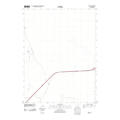
2010 Map of Tampa
USGS Topo · Published 2010About this map
Tampa sits as the central point of reference in this High Plains landscape, where the modern corridor of Interstate 76 intersects with older rural routes in Weld County. The terrain is defined by the ephemeral drainage patterns of Ennis Draw and Lost Creek, which weave through a largely open agricultural and industrial expanse. Industrial activity is evident at the Keenesburg Strip Mine, located north of County Rd 20 and west of County Rd 61. This transition between ranching and resource extraction is further anchored by landmarks such as the Lutz Ranch in the northwest. The grid of county roads, including County Rd 73 and the I 76 Frontage Rd, illustrates the persistent importance of land-section boundaries in organizing the rural Colorado settlement pattern during the early 21st century.
Find a feature on this map
9 named features on this map. Tap any name to fly to it.
Don’t see what you’re looking for? This feature index may not catch every label — zoom into the map to look around manually.
Map Details
Editions of this 2010 Tampa Map
This is the sole edition of this map. No revisions or reprints were ever made.
Other maps of this area

1902 · Greeley
USGS Topo · 1:125,000

1950 · South Roggen
USGS Topo · 1:24,000

1950 · Tampa
USGS Topo · 1:24,000

1950 · Keenesburg
USGS Topo · 1:24,000

1950 · Prospect Valley
USGS Topo · 1:24,000

1950 · Klug Ranch
USGS Topo · 1:24,000

1950 · Valley View School
USGS Topo · 1:24,000

1950 · Hardin
USGS Topo · 1:24,000

1951 · Keenesburg
USGS Topo · 1:24,000

1951 · Prospect Valley
USGS Topo · 1:24,000