
1950 Map of Hardin
USGS Topo · Published 1971About this map
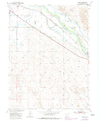
The South Platte River carves through this Colorado landscape, defining a corridor of intensive irrigation and rail transport at mid-century. The Union Pacific railroad tracks run parallel to the river, serving the small settlements of Hardin and Kuner. The complex network of water management is the most striking element of the survey, with the Latham Ditch, Empire Intake Canal, and Riverside Canal lacing across the valley floor to support local agriculture. In the more rural sections, the Kuner School and the Seventy Ranch stand as primary landmarks for local history and genealogy research. The terrain transition is evident where the canal-irrigated bottomlands meet the undulating higher ground, marked by numerous windmills and the (Old Channel) Creek near the Bijou Dam.
Find a feature on this map
17 named features on this map. Tap any name to fly to it.
Don’t see what you’re looking for? This feature index may not catch every label — zoom into the map to look around manually.
Map Details
Editions of this 1950 Hardin Map
2 editions found
Other maps of this area

1902 · Greeley
USGS Topo · 1:125,000

1950 · Kersey
USGS Topo · 1:24,000

1950 · Tampa
USGS Topo · 1:24,000

1950 · Barnesville
USGS Topo · 1:24,000

1950 · Klug Ranch
USGS Topo · 1:24,000

1950 · Valley View School
USGS Topo · 1:24,000
1951 · Klug Ranch
USGS Topo · 1:24,000

1951 · Hardin
USGS Topo · 1:24,000
1951 · Valley View School
USGS Topo · 1:24,000

1951 · Roggen
USGS Topo · 1:24,000