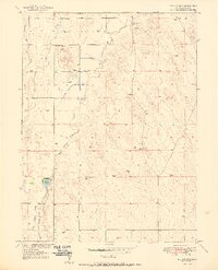
1951 Map of Klug Ranch
USGS Topo · Published 1951About this map
Klug Ranch and the surrounding high plains of Weld County come into focus during this 1951 survey, which captures a landscape defined by water management and ranching operations. The topography is shaped by the winding course of Box Elder Creek and the presence of Klug Lake to the south. This area demonstrates the reliance on irrigation in the mid-century West, evidenced by the West Neres Canal and the notation of the East Neres Canal (Abandoned), suggesting a shift in local water infrastructure during the era. Small-scale rural life is anchored by the Sky View School and dozens of scattered windmills that dot the terrain, marking the locations of essential groundwater wells for livestock. This map provides a clear record of the settlement patterns and agricultural infrastructure in the Missouri River Basin development area shortly after the war.
Find a feature on this map
8 named features on this map. Tap any name to fly to it.
Don’t see what you’re looking for? This feature index may not catch every label — zoom into the map to look around manually.
Map Details
Editions of this 1951 Klug Ranch Map
2 editions found
Other maps of this area

1902 · Greeley
USGS Topo · 1:125,000

1949 · Hudson
USGS Topo · 1:24,000

1950 · Tampa
USGS Topo · 1:24,000

1950 · Keenesburg
USGS Topo · 1:24,000

1950 · Prospect Valley
USGS Topo · 1:24,000

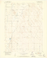
1950 · Klug Ranch
USGS Topo · 1:24,000

1950 · Valley View School
USGS Topo · 1:24,000

1950 · Hardin
USGS Topo · 1:24,000
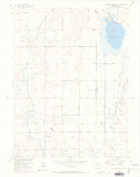
1950 · Milton Reservoir
USGS Topo · 1:24,000

1950 · La Salle
USGS Topo · 1:24,000