
1950 Map of Tampa
USGS Topo · Published 1952About this map
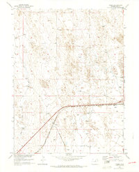
Tampa and the surrounding high plains of Weld County are defined by a sparse but deliberate network of water sources and transit lines in this 1950 landscape. The Chicago Burlington and Quincy railroad cuts a sharp diagonal through the terrain, serving as the primary corridor for movement and communication in an area dominated by cattle ranching and dryland agriculture. The presence of numerous Windmill sites across the quadrangle indicates the critical importance of groundwater for sustaining the small settlements and isolated outposts like Lutz Ranch. Seasonal drainage patterns are traced by the winding courses of Ennis Draw and Lost Creek, which provide the only relief to the rhythmic topography of the eastern Colorado plains. This survey, conducted as part of the Department of the Interior's Missouri River Basin development program, offers a clear record of the rural infrastructure before late-century shifts in land use and ranching technology.
Find a feature on this map
7 named features on this map. Tap any name to fly to it.
Don’t see what you’re looking for? This feature index may not catch every label — zoom into the map to look around manually.
Map Details
Editions of this 1950 Tampa Map
4 editions found
Other maps of this area

1902 · Greeley
USGS Topo · 1:125,000

1950 · South Roggen
USGS Topo · 1:24,000

1950 · Keenesburg
USGS Topo · 1:24,000

1950 · Prospect Valley
USGS Topo · 1:24,000

1950 · Klug Ranch
USGS Topo · 1:24,000

1950 · Valley View School
USGS Topo · 1:24,000

1950 · Hardin
USGS Topo · 1:24,000

1951 · Keenesburg
USGS Topo · 1:24,000

1951 · Prospect Valley
USGS Topo · 1:24,000
1951 · Klug Ranch
USGS Topo · 1:24,000