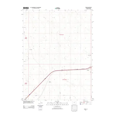
2013 Map of Tampa
USGS Topo · Published 2013About this map
Tampa and Roggen anchor the southern portion of this Weld County landscape, situated along the critical corridor of Interstate 76. This 2013 survey illustrates a high-plains environment defined by intermittent drainage systems and agricultural infrastructure. The terrain is marked by features such as Ennis Draw in the west and Sand Canyon to the east, which frame a series of undulating contours typical of the region. Lost Creek meanders through the central and eastern sections, providing a focal point for the natural topography.
Find a feature on this map
18 named features on this map. Tap any name to fly to it.
Don’t see what you’re looking for? This feature index may not catch every label — zoom into the map to look around manually.
Map Details
Editions of this 2013 Tampa Map
This is the sole edition of this map. No revisions or reprints were ever made.
Other maps of this area

1902 · Greeley
USGS Topo · 1:125,000

1950 · South Roggen
USGS Topo · 1:24,000

1950 · Tampa
USGS Topo · 1:24,000

1950 · Keenesburg
USGS Topo · 1:24,000

1950 · Prospect Valley
USGS Topo · 1:24,000

1950 · Klug Ranch
USGS Topo · 1:24,000

1950 · Valley View School
USGS Topo · 1:24,000

1950 · Hardin
USGS Topo · 1:24,000

1951 · Keenesburg
USGS Topo · 1:24,000

1951 · Prospect Valley
USGS Topo · 1:24,000