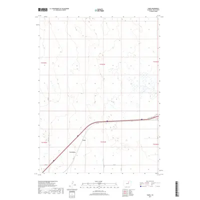
2019 Map of Tampa
USGS Topo · Published 2019About this map
Tampa and the neighboring community of Keenesburg anchor this 2019 survey of the High Plains in Weld County. The landscape is defined by its wide, open drainage patterns, most notably Ennis Draw in the west and the seasonal reach of Lost Cr to the south. Modern infrastructure creates a sharp corridor through the agricultural terrain, with Hwy 2 and Frontage Road I-76 providing the primary east-west transit artery.
Find a feature on this map
18 named features on this map. Tap any name to fly to it.
Don’t see what you’re looking for? This feature index may not catch every label — zoom into the map to look around manually.
Map Details
Editions of this 2019 Tampa Map
This is the sole edition of this map. No revisions or reprints were ever made.
Other maps of this area

1902 · Greeley
USGS Topo · 1:125,000

1950 · South Roggen
USGS Topo · 1:24,000

1950 · Tampa
USGS Topo · 1:24,000

1950 · Keenesburg
USGS Topo · 1:24,000

1950 · Prospect Valley
USGS Topo · 1:24,000

1950 · Klug Ranch
USGS Topo · 1:24,000

1950 · Valley View School
USGS Topo · 1:24,000

1950 · Hardin
USGS Topo · 1:24,000

1951 · Keenesburg
USGS Topo · 1:24,000

1951 · Prospect Valley
USGS Topo · 1:24,000