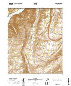
2017 Map of Tanana B-2 SW
USGS Topo · Published 2017About this map
Rampart Gorge dominates the northwestern corner of this interior Alaska landscape, where the mighty Yukon River carves through high, steep-sided terrain. This 2017 survey illustrates a wild and unpopulated reach of the Yukon-Koyukuk Census Area, defined by a complex drainage network including Stevens Cr and Texas Cr. The map's contour lines reveal the dramatic verticality of the gorge and the surrounding ridges, which drop sharply toward the riverbank. To the east, Fish Cr meanders through lower elevations, showing the variation between the river's main canyon and its smaller tributaries. This sheet provides a clear look at the topographic character of the Alaskan interior, where the lack of roads or established settlements emphasizes the dominance of the river systems and raw geological formations.
Find a feature on this map
9 named features on this map. Tap any name to fly to it.
Don’t see what you’re looking for? This feature index may not catch every label — zoom into the map to look around manually.
Map Details
Editions of this 2017 Tanana B-2 SW Map
This is the sole edition of this map. No revisions or reprints were ever made.
Other maps of this area

1951 · Tanana
USGS Topo · 1:250,000

1952 · Tanana A-3
USGS Topo · 1:63,360

1952 · Tanana A-2
USGS Topo · 1:63,360

1953 · Tanana A-2
USGS Topo · 1:63,360

1953 · Tanana A-3
USGS Topo · 1:63,360

1956 · Tanana B-2
USGS Topo · 1:63,360

1956 · Tanana B-3
USGS Topo · 1:63,360

1956 · Tanana
USGS Topo · 1:250,000

1960 · Tanana
USGS Topo · 1:250,000
2016 · Tanana B-3 NE
USGS Topo · 1:25,000