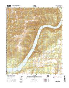
2016 Map of Tanana B-3 SE
USGS Topo · Published 2016About this map
The Yukon River carves a massive sweeping bend through this interior landscape, defining the topography of the Tanana B-3 SE quadrangle. The river’s power is most evident at The Rapids, a significant navigational point located where the channel constricts between rising terrain. Dominating the western central portion of the sheet is Senatis Mtn, which serves as a primary high-relief landmark overlooking the river valley. Numerous tributaries, including Windy Cr, Jordan Cr, and Texas Cr, drain the surrounding slopes into the main river channel. The map’s lack of modern development or named settlements highlights the persistent wilderness character of this reach of the Yukon, where the natural waterway remains the primary corridor for movement and life.
Find a feature on this map
12 named features on this map. Tap any name to fly to it.
Don’t see what you’re looking for? This feature index may not catch every label — zoom into the map to look around manually.
Map Details
Editions of this 2016 Tanana B-3 SE Map
This is the sole edition of this map. No revisions or reprints were ever made.
Other maps of this area

1951 · Tanana
USGS Topo · 1:250,000

1952 · Tanana A-3
USGS Topo · 1:63,360

1952 · Tanana A-2
USGS Topo · 1:63,360

1953 · Tanana A-2
USGS Topo · 1:63,360

1953 · Tanana A-3
USGS Topo · 1:63,360

1956 · Tanana B-2
USGS Topo · 1:63,360

1956 · Tanana B-3
USGS Topo · 1:63,360

1956 · Tanana
USGS Topo · 1:250,000

1960 · Tanana
USGS Topo · 1:250,000
2016 · Tanana B-3 NE
USGS Topo · 1:25,000