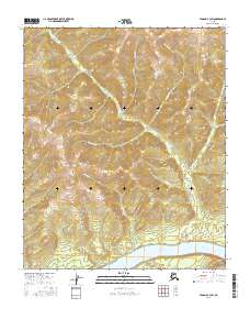
2016 Map of Tanana B-3 SW
USGS Topo · Published 2016About this map
The Yukon River dominates the southern reaches of this landscape, serving as the primary drainage and historical transport artery for the surrounding interior. This section of the river valley is characterized by several major tributaries that carve through the upland terrain, including Morelock Cr, Maggie Cr, and Bonanza Cr. The naming conventions of these waterways, particularly Homestake Cr and Quartz Cr, hint at the prospecting history that defined this region of Alaska during earlier gold-seeking eras.
Find a feature on this map
13 named features on this map. Tap any name to fly to it.
Don’t see what you’re looking for? This feature index may not catch every label — zoom into the map to look around manually.
Map Details
Editions of this 2016 Tanana B-3 SW Map
This is the sole edition of this map. No revisions or reprints were ever made.
Other maps of this area

1951 · Tanana
USGS Topo · 1:250,000

1952 · Tanana A-3
USGS Topo · 1:63,360

1952 · Tanana A-4
USGS Topo · 1:63,360

1953 · Tanana A-3
USGS Topo · 1:63,360

1956 · Tanana B-3
USGS Topo · 1:63,360

1956 · Tanana B-4
USGS Topo · 1:63,360

1956 · Tanana
USGS Topo · 1:250,000

1960 · Tanana
USGS Topo · 1:250,000
2016 · Tanana B-3 NE
USGS Topo · 1:25,000
2016 · Tanana B-4 SE
USGS Topo · 1:25,000