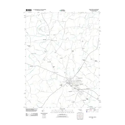
2011 Map of Taneytown
USGS Topo · Published 2011About this map
The Mason and Dixon Line defines the northern boundary of this Piedmont landscape, separating Maryland from Pennsylvania. The city of Taneytown serves as the regional hub, surrounded by a dense network of residential developments such as Cunningham Acres, Trevanion Terrace, and Fairground Village. Agricultural heritage remains visible through named tracts like Monocacy Farms and Sewells Farm, while the drainage patterns of the Monocacy River and Piney Creek shape the rural outskirts. Local history is anchored by numerous spiritual and civic sites, including the Taneytown Post Office and several prominent burial grounds like Saint Joseph Cemetery and Trinity Cemetery. Smaller crossroads like Harney and Galt mark the historic transit routes that have long connected these farming communities.
Find a feature on this map
124 named features on this map. Tap any name to fly to it.
Don’t see what you’re looking for? This feature index may not catch every label — zoom into the map to look around manually.
Map Details
Editions of this 2011 Taneytown Map
This is the sole edition of this map. No revisions or reprints were ever made.
Other maps of this area

1908 · Gettysburg
USGS Topo · 1:62,500

1909 · Fairfield
USGS Topo · 1:62,500

1911 · Taneytown
USGS Topo · 1:62,500

1911 · Emmitsburg
USGS Topo · 1:62,500

1942 · Gettysburg
USGS Topo · 1:125,000

1943 · Emmitsburg
USGS Topo · 1:62,500

1944 · Union Bridge
USGS Topo · 1:31,680

1944 · Gettysburg
USGS Topo · 1:31,680

1944 · New Windsor
USGS Topo · 1:31,680

1944 · Mc Sherrystown
USGS Topo · 1:31,680