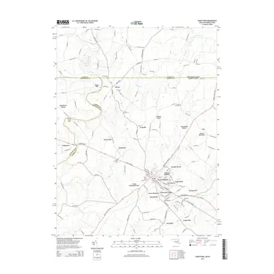
2014 Map of Taneytown
USGS Topo · Published 2014About this map
Taneytown serves as the focal point of this Maryland landscape, characterized by its historical residential developments like Green Meadows and Wheatfields alongside the agricultural heritage of Carroll County. The town is ringed by a high density of religious and family burial sites, including Trinity Cem, Grace Cem, and Saint Joseph Cem. To the north and west, the terrain is defined by the winding paths of the Monocacy River and Piney Creek, where local landmarks like Mairs Mill and the Bullfrog Road Bridge indicate a history of river-based commerce and early transport. The border between Maryland and Pennsylvania marks the northern extent of the quadrangle, where smaller rural hubs like Harney and Galt sit among a network of family-named roads. This 2014 survey documents the persistence of small-scale settlements such as Stumptown and Copperville, providing a detailed view of the region's modern layout while preserving the names of its ancestral landmarks.
Find a feature on this map
130 named features on this map. Tap any name to fly to it.
Don’t see what you’re looking for? This feature index may not catch every label — zoom into the map to look around manually.
Map Details
Editions of this 2014 Taneytown Map
This is the sole edition of this map. No revisions or reprints were ever made.
Other maps of this area

1908 · Gettysburg
USGS Topo · 1:62,500

1909 · Fairfield
USGS Topo · 1:62,500

1911 · Taneytown
USGS Topo · 1:62,500

1911 · Emmitsburg
USGS Topo · 1:62,500

1942 · Gettysburg
USGS Topo · 1:125,000

1943 · Emmitsburg
USGS Topo · 1:62,500

1944 · Union Bridge
USGS Topo · 1:31,680

1944 · Gettysburg
USGS Topo · 1:31,680

1944 · New Windsor
USGS Topo · 1:31,680

1944 · Mc Sherrystown
USGS Topo · 1:31,680