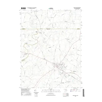
2016 Map of Taneytown
USGS Topo · Published 2016About this map
Taneytown serves as the central hub of this 2016 survey, situated at the crossroads of a region where agricultural traditions meet modern Maryland infrastructure. The map illustrates a dense concentration of community landmarks within the town itself, including Grace Cem, Trinity Cem, and Saint Joseph Cem. To the northwest, the border between Maryland and Pennsylvania is clearly delineated, passing through the village of Harney and near the historic site of Mairs Mill.
Find a feature on this map
128 named features on this map. Tap any name to fly to it.
Don’t see what you’re looking for? This feature index may not catch every label — zoom into the map to look around manually.
Map Details
Editions of this 2016 Taneytown Map
This is the sole edition of this map. No revisions or reprints were ever made.
Other maps of this area

1908 · Gettysburg
USGS Topo · 1:62,500

1909 · Fairfield
USGS Topo · 1:62,500

1911 · Taneytown
USGS Topo · 1:62,500

1911 · Emmitsburg
USGS Topo · 1:62,500

1942 · Gettysburg
USGS Topo · 1:125,000

1943 · Emmitsburg
USGS Topo · 1:62,500

1944 · Union Bridge
USGS Topo · 1:31,680

1944 · Gettysburg
USGS Topo · 1:31,680

1944 · New Windsor
USGS Topo · 1:31,680

1944 · Mc Sherrystown
USGS Topo · 1:31,680