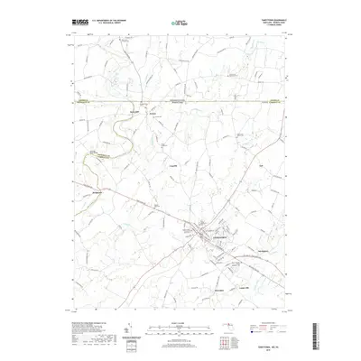
2019 Map of Taneytown
USGS Topo · Published 2019About this map
Taneytown serves as the focal point of this Maryland and Pennsylvania border region, where a dense network of country roads connects historic farming communities and religious centers. The landscape is defined by the convergence of several major watercourses, including the Monocacy River, Piney Creek, and Big Pipe Creek, which historically powered local industry like Mairs Mill. Genealogists will find a wealth of records in the numerous well-preserved churchyards such as Saint Joseph Cem, Grace United Church of Christ Cem, and Mount Joy Lutheran Cem. The map illustrates the persistent 18th-century settlement patterns of Carroll and Frederick Counties, where smaller hamlets like Harney, Bridgeport, and Ottersdale remain distinct from the larger regional center. This transition from the Maryland Piedmont toward the Pennsylvania line is characterized by long-standing road corridors like the Taneytown Pike.
Find a feature on this map
139 named features on this map. Tap any name to fly to it.
Don’t see what you’re looking for? This feature index may not catch every label — zoom into the map to look around manually.
Map Details
Editions of this 2019 Taneytown Map
This is the sole edition of this map. No revisions or reprints were ever made.
Other maps of this area

1908 · Gettysburg
USGS Topo · 1:62,500

1909 · Fairfield
USGS Topo · 1:62,500

1911 · Taneytown
USGS Topo · 1:62,500

1911 · Emmitsburg
USGS Topo · 1:62,500

1942 · Gettysburg
USGS Topo · 1:125,000

1943 · Emmitsburg
USGS Topo · 1:62,500

1944 · Union Bridge
USGS Topo · 1:31,680

1944 · Gettysburg
USGS Topo · 1:31,680

1944 · New Windsor
USGS Topo · 1:31,680

1944 · Mc Sherrystown
USGS Topo · 1:31,680