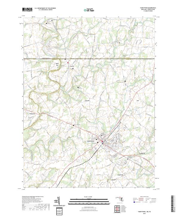
2023 Map of Taneytown
USGS Topo · Published 2023About this map
Taneytown serves as the focal point of this region where the rolling hills of Carroll County meet the Pennsylvania-Maryland border. The landscape is defined by the drainage basins of the Monocacy River and Piney Creek, which historically powered local industry at sites like Mairs Mill. This contemporary survey highlights a high density of rural religious and burial sites, including the Grace United Church of Christ Cemetery and Saint Joseph Cemetery within the town limits, as well as outlying landmarks like Piney Creek Church Cemetery to the north.
Find a feature on this map
138 named features on this map. Tap any name to fly to it.
Don’t see what you’re looking for? This feature index may not catch every label — zoom into the map to look around manually.
Map Details
Editions of this 2023 Taneytown Map
This is the sole edition of this map. No revisions or reprints were ever made.
Historical Maps of Mairs Mill Through Time
4 maps found