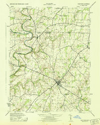
1944 Map of Taneytown
USGS Topo · Published 1944About this map
Taneytown serves as the central hub of this 1944 survey, where the Maryland and Pennsylvania borderlands meet in a landscape of small agricultural settlements and rural institutions. The crossing of the Monocacy River at Bridgeport and the winding course of Marsh Creek define the western reaches, while the northern boundary is marked by Boundary Monument No 75. Industry and social infrastructure of the mid-century are visible through landmarks like Mairs Mill, Starners Dam, and the Sewage Disposal Plant. Genealogists and local historians can trace the distribution of early education and community care through several named facilities, including Centennial Hall School, Ottersdale School, and Hoffmans Orphanage. The presence of the Taneytown Airport and the Carroll Co Fairgrounds reflects the area's role as a regional gathering point just before the post-war expansion.
Find a feature on this map
40 named features on this map. Tap any name to fly to it.
Don’t see what you’re looking for? This feature index may not catch every label — zoom into the map to look around manually.
Map Details
Editions of this 1944 Taneytown Map
This is the sole edition of this map. No revisions or reprints were ever made.
Other maps of this area

1908 · Gettysburg
USGS Topo · 1:62,500

1909 · Fairfield
USGS Topo · 1:62,500

1911 · Taneytown
USGS Topo · 1:62,500

1911 · Emmitsburg
USGS Topo · 1:62,500

1942 · Gettysburg
USGS Topo · 1:125,000

1943 · Emmitsburg
USGS Topo · 1:62,500

1944 · Union Bridge
USGS Topo · 1:31,680

1944 · Gettysburg
USGS Topo · 1:31,680

1944 · New Windsor
USGS Topo · 1:31,680

1944 · Mc Sherrystown
USGS Topo · 1:31,680