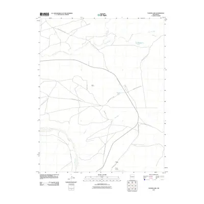
2010 Map of Tanner Lake
USGS Topo · Published 2010About this map
Tsaya and the dramatic landscape of Tsaya Canyon anchor this portion of the Eastern Navajo Agency. The terrain is defined by a complex network of intermittent drainages, most notably the Chaco River and its various tributaries like De-na-zin Wash and Rock Wash. These seasonal watercourses dictate the local geography, carving through the high desert floor and creating natural landmarks such as Dog Eye Pond and Tanner Lake.
Find a feature on this map
20 named features on this map. Tap any name to fly to it.
Don’t see what you’re looking for? This feature index may not catch every label — zoom into the map to look around manually.
Map Details
Editions of this 2010 Tanner Lake Map
This is the sole edition of this map. No revisions or reprints were ever made.
Other maps of this area

1889 · Chaco
USGS Topo · 1:250,000

1892 · Chaco
USGS Topo · 1:250,000

1927 · Sulphur Spring
USGS Topo · 1:96,000

1928 · Kirtland
USGS Topo · 1:125,000

1932 · Kirtland
USGS Topo · 1:125,000

1954 · Shiprock
USGS Topo · 1:250,000

1958 · Shiprock
USGS Topo · 1:250,000

1959 · Shiprock
USGS Topo · 1:250,000
1966 · Tanner Lake
USGS Topo · 1:24,000
1966 · Alamo Mesa East
USGS Topo · 1:24,000