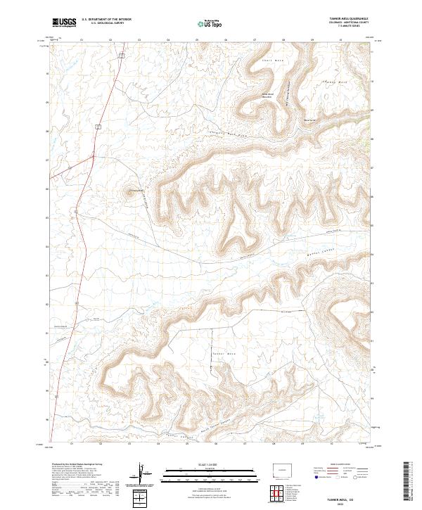
2022 Map of Tanner Mesa
USGS Topo · Published 2022About this map
Mancos River carves through the heart of this high-desert landscape, creating the deep Mancos Canyon that separates the massive Mesa Verde upland to the north from the broad expanse of Tanner Mesa to the south. The terrain is defined by dramatic elevation shifts and prominent landmarks like Chimney Rock, which stands as a sentinel overlooking the intersection of Chimney Rock Draw and the river valley.
Find a feature on this map
27 named features on this map. Tap any name to fly to it.
Don’t see what you’re looking for? This feature index may not catch every label — zoom into the map to look around manually.
Map Details
Editions of this 2022 Tanner Mesa Map
This is the sole edition of this map. No revisions or reprints were ever made.
Other maps of this area

1889 · Chaco
USGS Topo · 1:250,000

1892 · Chaco
USGS Topo · 1:250,000

1934 · Chimney Rock
USGS Topo · 1:62,500

1934 · Rattlesnake
USGS Topo · 1:62,500

1936 · Chimney Rock
USGS Topo · 1:62,500

1937 · Rattlesnake
USGS Topo · 1:62,500

1954 · Shiprock
USGS Topo · 1:250,000

1956 · Cortez
USGS Topo · 1:250,000

1958 · Sentinel Peak NE
USGS Topo · 1:24,000

1958 · Cortez
USGS Topo · 1:250,000