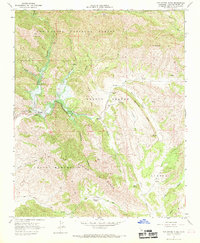
1967 Map of Tar Spring Ridge
USGS Topo · Published 1969About this map
Lopez Dam Spillway is a focal point of this late 1960s survey, shown while the reservoir area was still undergoing significant transformation. Labels for a Proposed Location and areas marked Under Construction detail the expansion of the water infrastructure along Arroyo Grande Creek, which flows into the basin near Lopez Park. The map documents a landscape defined by steep ridges and deep canyons, where rural life persisted at established sites like Ranchita Ranch and Tar Spring Ranch.
Find a feature on this map
34 named features on this map. Tap any name to fly to it.
Don’t see what you’re looking for? This feature index may not catch every label — zoom into the map to look around manually.
Map Details
Editions of this 1967 Tar Spring Ridge Map
2 editions found

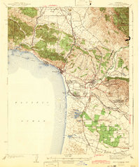
Other maps of this area

1897 · San Luis Obispo
USGS Topo · 1:62,500

1897 · Arroyo Grande
USGS Topo · 1:62,500

1900 · San Luis
USGS Topo · 1:125,000

1922 · Pozo
USGS Topo · 1:62,500

1922 · Nipomo
USGS Topo · 1:62,500

1942 · San Luis Obispo
USGS Topo · 1:62,500
1942 · Arroyo Grande
USGS Topo · 1:62,500

1947 · San Luis Obispo
USGS Topo · 1:250,000

1948 · San Luis Obispo
USGS Topo · 1:250,000
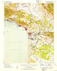
1952 · Arroyo Grande
USGS Topo · 1:62,500