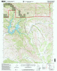
1995 Map of Tar Spring Ridge
USGS Topo · Published 2000About this map
Santa Manuela Grant and Huasna Grant anchor the southern portion of this landscape, reflecting the deep-rooted land tenure patterns of San Luis Obispo County. The 1990s terrain is dominated by the reservoir of Lopez Lake, which provides a central focus for the Lopez Lake Recreation Area and its surrounding canyons. This era shows a complex managed landscape where the Los Padres National Forest and the protected Santa Lucia Wilderness meet working lands like Ranchita Ranch and Park Ranch. Notable infrastructure from the mid-90s includes the Arroyo-Grande Helicopter Base and various gaging stations along Arroyo Grande Creek, while the rugged Tar Spring Ridge and Big Baldy define the high country above the numerous creek drainages such as Saucelito Creek and Huasna Creek.
Find a feature on this map
39 named features on this map. Tap any name to fly to it.
Don’t see what you’re looking for? This feature index may not catch every label — zoom into the map to look around manually.
Map Details
Editions of this 1995 Tar Spring Ridge Map
This is the sole edition of this map. No revisions or reprints were ever made.
Other maps of this area

1897 · San Luis Obispo
USGS Topo · 1:62,500

1897 · Arroyo Grande
USGS Topo · 1:62,500

1900 · San Luis
USGS Topo · 1:125,000

1922 · Pozo
USGS Topo · 1:62,500

1922 · Nipomo
USGS Topo · 1:62,500

1942 · San Luis Obispo
USGS Topo · 1:62,500

1942 · Arroyo Grande
USGS Topo · 1:62,500

1947 · San Luis Obispo
USGS Topo · 1:250,000

1948 · San Luis Obispo
USGS Topo · 1:250,000

1952 · Arroyo Grande
USGS Topo · 1:62,500