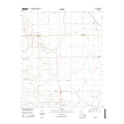
2014 Map of Tarry
USGS Topo · Published 2014About this map
Bayou Bartholomew meanders through the heart of this landscape, defining the rural character of southeastern Arkansas as it crosses the boundary between Jefferson and Lincoln counties. The waterway is flanked by a series of small, dispersed communities including Tamo, Tarry, and Yorktown, connected by a network of local routes like Us 425 HWY N and Belmont Rd. The agricultural orientation of the region is evident in the prevalence of drainage features like Deep Bayou and Spencer Cr, which manage the low-lying terrain alongside oxbow formations such as Clowers Lake and Marks Lake. Local heritage is anchored by sites of community and memory, notably Atkinson Ford Bridge and several burial grounds, including Marzel Cem and White Church Cem. The map provides a detailed view of the early 21st-century settlement pattern, where named locales such as Whitefield and Phenix represent the enduring rural infrastructure of the Arkansas Delta.
Find a feature on this map
60 named features on this map. Tap any name to fly to it.
Don’t see what you’re looking for? This feature index may not catch every label — zoom into the map to look around manually.
Map Details
Editions of this 2014 Tarry Map
This is the sole edition of this map. No revisions or reprints were ever made.
Other maps of this area

1935 · Feenyville
USGS Topo · 1:62,500

1935 · Varner
USGS Topo · 1:62,500

1935 · Noble Lake
USGS Topo · 1:62,500

1935 · Rotan
USGS Topo · 1:62,500

1948 · Helena
USGS Topo · 1:250,000

1950 · Helena
USGS Topo · 1:250,000

1953 · Greenwood
USGS Topo · 1:250,000

1955 · Helena
USGS Topo · 1:250,000

1956 · Greenwood
USGS Topo · 1:250,000

1959 · Helena
USGS Topo · 1:250,000