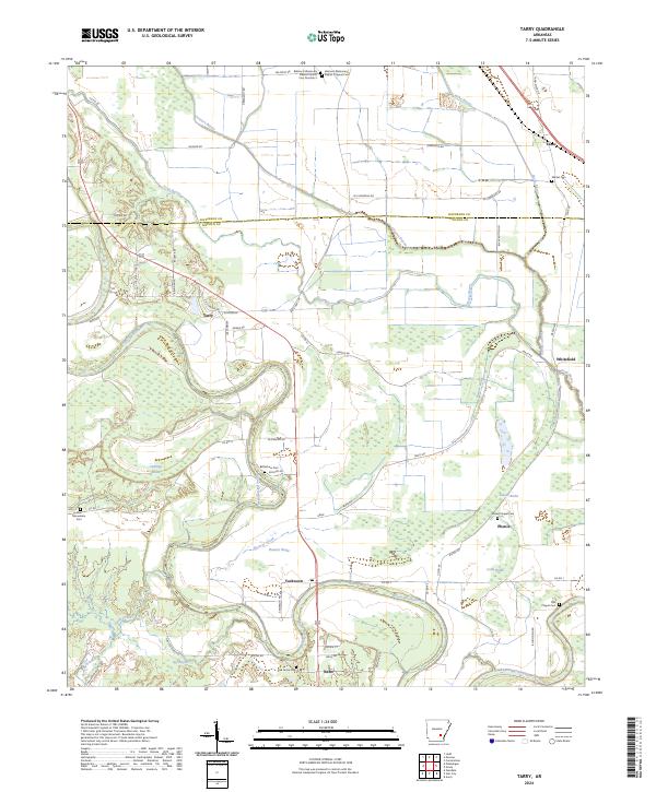
2024 Map of Tarry
USGS Topo · Published 2024About this map
Bayou Bartholomew winds through the southern reaches of this landscape, its serpentine path defining the hydrology near Yorktown and Nebo. The terrain is marked by numerous brakes and backwaters, including Beaver Brake and Hunters Brake, reflecting the low-lying alluvial nature of this portion of Lincoln County. This area serves as a primary drainage corridor where Cousart Bayou and Deep Bayou converge toward the larger river system.
Find a feature on this map
72 named features on this map. Tap any name to fly to it.
Don’t see what you’re looking for? This feature index may not catch every label — zoom into the map to look around manually.
Map Details
Editions of this 2024 Tarry Map
This is the sole edition of this map. No revisions or reprints were ever made.
Other maps of this area

1935 · Feenyville
USGS Topo · 1:62,500

1935 · Varner
USGS Topo · 1:62,500

1935 · Noble Lake
USGS Topo · 1:62,500

1935 · Rotan
USGS Topo · 1:62,500

1948 · Helena
USGS Topo · 1:250,000

1950 · Helena
USGS Topo · 1:250,000

1953 · Greenwood
USGS Topo · 1:250,000

1955 · Helena
USGS Topo · 1:250,000

1956 · Greenwood
USGS Topo · 1:250,000

1959 · Helena
USGS Topo · 1:250,000