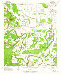
1964 Map of Tarry
USGS Topo · Published 1965About this map
Bartholomew Bayou winds in tight oxbows across this delta landscape, defining the agricultural character of southeastern Jefferson and Lincoln Counties in the mid-1960s. The region is marked by a dense network of swampy brakes and bayous, including Deep Bayou, Cousart Bayou, and Hastings Brake, which weave between fertile tracts identified as Melton and Rich Land. This environment shaped a dispersed settlement pattern centered on rural spiritual life, evidenced by numerous country churches such as Bright Star Ch, Daniels Chapel, and White Church.
Find a feature on this map
43 named features on this map. Tap any name to fly to it.
Don’t see what you’re looking for? This feature index may not catch every label — zoom into the map to look around manually.
Map Details
Editions of this 1964 Tarry Map
This is the sole edition of this map. No revisions or reprints were ever made.
Other maps of this area

1935 · Feenyville
USGS Topo · 1:62,500

1935 · Varner
USGS Topo · 1:62,500

1935 · Noble Lake
USGS Topo · 1:62,500

1935 · Rotan
USGS Topo · 1:62,500

1948 · Helena
USGS Topo · 1:250,000

1950 · Helena
USGS Topo · 1:250,000

1953 · Greenwood
USGS Topo · 1:250,000

1955 · Helena
USGS Topo · 1:250,000

1956 · Greenwood
USGS Topo · 1:250,000

1959 · Helena
USGS Topo · 1:250,000